

 | Hôm nay | 573 |
 | Hôm qua | 1701 |
 | Tuần này | 2274 |
 | Tuần trước | 12454 |
 | Tháng này | 573 |
 | Tháng trước | 48979 |
 | Tất cả | 550441 |
IP máy bạn: 216.73.216.195
Mozilla 5.0,
Hôm nay: 01-Jul-2025
|
|
|
|
|
|
|
|
|
|
|
|
|
|
|
|
| 4. ENGINEERING GEOLOGY |
|
- Map of load bearing capacity of soil base
2. Soil investigation for various civil engineering - Geotechnical exploratory drilling up to 100m deep onshore and offshore. - Standard penetration test and static cone penetration test. - Vane shear test. - Static plate load test and collapse load test in pit. 3. Soil treatment - Excavation dewatering. - Sand pile and prefabricated vertical drains with preloading. - Pour pile and sonic test on pour piles. 4. Thematic studies - Application of informatics technology in management and exploitation of engineering geological data. Monitoring for horizontal deformation. - Monitoring for pore pressure. - Investigation, monitoring and determination of generation mechanism, driving forces and trigger factors causing landslides on slopes. 5. Special software a) Geo- Slope Office V.5 - GEO-SLOPE OFFICE V.5 is a product of GEOSLOPE International –Canada. GEO-SLOPE OFFICE V.5 includes 6 packages: - SEEP/W is a finite element software, used for modeling movement of water and distribution of pore pressure in porous media. - SIGMA/W is a finite element software, used for analyzing stress-strain in soil and rock media, from simple linear deformation to complex non-linear effective stress elastic-plastic deformation. - SLOPE/W is a finite element software, used for analyzing slope stability of a saturated and unsaturated soil and rock slope. SLOPE/W has application in the analysis and design for geotechnical, civil, and mining engineering projects. - QUAKE/W is a geotechnical finite element software product for the dynamic analysis of earth structures subjected to earthquake shaking. It can also be used to compute the excess pore-water pressures that may be generated. Once the QUAKE/W analysis is complete, the resulting stresses and pore-water pressures can then be used in SLOPE/W to analyze the stability aspects of the problem. - CTRAN/W is a finite element software product that can be used to model the movement of contaminants through porous materials such as soil and rock. The comprehensive formulation of CTRAN/W makes it possible to analyze problems varying from simple particle tracking in response to the movement of water, to complex processes involving diffusion, dispersion, adsorption
 b) Plaxis V. 7.2 - Plaxis is a finite element package specifically intended for the analysis of deformation and stability in geotechnical engineering projects. - Geotechnical applications require advanced constitutive models for the simulation of the non-linear and time-dependent behavior of soils. - Since soil is a multi-phase material, special procedures are required to deal with hydrostatic and non-hydrostatic pore pressures in the soil. - Plaxis is equipped with special features to deal with the numerous aspects of complex geotechnical structures.
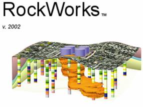
c) RockWork - Management of borehole data and input of geophisic, chemical, lithological, stratigraphical, water level, fracture and borehole parameters. - Display various types of boring logs, stratigraphy, cross sections, fence sections and block schemes. - Contains series of geological facilities for generating maps of isolines, mesh, block schemes, calculating volumes, hydrogeological and geochemical facilities...
|


